U Texas Austin and IBM Shore Up Flood Prediction Technology
- By Dian Schaffhauser
- 09/01/11
As weather becomes more extreme and flooding more common, the ability to predict the likelihood of flooding beforehand in a given geographic area would be a real boon to safety and preparedness. A team of researchers at the University of Texas at Austin and IBM is working to develop technology that could tackle just such a problem right now. They're applying advanced analytics specifically to river systems, weather, and sensor data to predict Texas' Guadalupe River's behavior.
The Guadalupe, which runs 230 miles from Kerr County to San Antonio Bay on the Gulf of Mexico, is prone to severe flooding in spite of a series of dams operated by the Army Corps of Engineers. The traditional approach to flood prediction methods focuses on the main stems of the largest rivers, but the Guadalupe actually has a drainage area of about 6,070 square miles consisting of thousands of creeks, streams, and tinier flows of water.
| | 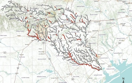
UT Austin and IBM's flood prediction technology can model 100 hours of Guadalupe River each hour. | |
According to Frank Liu, research staff member at IBM Research in Austin, flood preparedness could be viewed as a "large scale computing problem, with a huge number of relevant data and independencies."
To study the full impact of the behavior of these numerous branches, the research team is working with flood prediction technology running on computers loaded with IBM Power7 multi-core processors to simulate tens of thousands of river branches at a time. By applying analytics to advanced weather simulation models, municipalities and disaster response teams could make emergency plans and pinpoint potential flood areas on a river days in advance, the researchers reported in a statement.
As a testing ground, the scientists are presently applying the model to predict the entire 230 mile-long Guadalupe River and over 9,000 miles of tributaries in Texas. In a single hour the system can currently generate up to 100 hours of river behavior.
"Combining IBM's complex system modeling with our research into river physics, we've developed new ways to look at an old problem," said Ben Hodges, associate professor at the university's Center for Research in Water Resources. Hodges' area of specialty is environmental fluid mechanics, the study of fluid flow. "Unlike previous methods, the IBM approach scales-up for massive networks and has the potential to simulate millions of river miles at once. With the use of river sensors integrated into web-based information systems, we can take this model even further."
Professors at the university have been linking the river model directly to the National Weather Service's NEXRAD weather radar detection systems to better predict flood risk on a creek-by-creek basis.
The same research could eventually be applied to the problem of irrigation management. The research team said the analytics could be used to create equitable water-sharing plans that ensure compliance with habitat conservation efforts. The models could allow water managers to evaluate "what if" scenarios to create better plans for handling both droughts and water surplus.
About the Author
Dian Schaffhauser is a former senior contributing editor for 1105 Media's education publications THE Journal, Campus Technology and Spaces4Learning.