Updated Johns Hopkins Coronavirus Map Adds Local Data
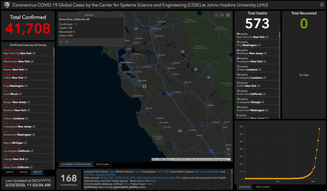
Screen capture of coronavirus data from Santa Clara County, CA, as of March 23, 2020
Johns Hopkins University has upgraded its COVID-19 tracking map to include local data from every city and county in the United States. When users zoom in on the U.S. map, they can now click on each county to display the numbers of confirmed cases, active cases, deaths and recoveries for that jurisdiction.
State- and local-level information can also be viewed through the vertical country column on the left-hand side of the map; when users click on "U.S." in that column, they can then navigate to state and local data via the "Admin" tabs at the bottom of the column.
The update will also "allow for adding features later that will deliver broader insights about the pandemic," according to the university, and all the map data continues to be freely available in a GitHub repository.
The map and additional resources are available on Johns Hopkins' online portal.
About the Author
Rhea Kelly is editor in chief for Campus Technology, THE Journal, and Spaces4Learning. She can be reached at [email protected].